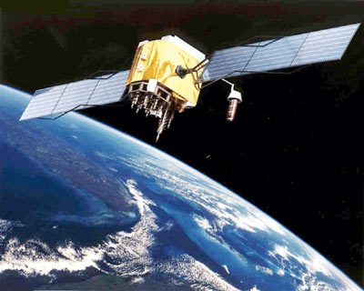
When PSLV-C22 lifts off with IRNSS-1A satellite in tow from Sriharikota on Monday, it will mark India’s first step towards building its own satellite navigation system. Named IRNSS for Indian Regional Navigation Satellite System, it will be one of the few navigation systems in the world and will provide an alternative to systems like the GPS (global positioning system) owned by the US, for navigation in and around India.
Most countries build their own navigation systems because global systems like GPS owned by a single country cannot be relied upon in times of war and conflict. This system will ensure India has access to navigation systems in hostile situations. While the US operates a GPS, Russia has its own GLONASS (global navigation satellite system). China is building its BeiDou navigation satellite system (also called COMPASS) and the European Union is developing Galileo for its own needs.
“Apart from making us self-reliant, it is also about building technological capability. We already have communication satellites. Navigation satellites are the next step,” said Deviprasad Karnik, chief spokesperson at the Indian Space Research Organisation (Isro). He said the entire development was indigenous apart from a few critical components.
IRNSS consists of seven satellites, three in geostationary orbit and four in inclined geosynchronous orbit, and will mainly cover the area around India. A geosynchronous orbit leads to satellite passing over the same locations over the earth at the same time every day. A geostationary orbit, a special form of geosynchronous orbit, means the satellite will always be over a certain point on earth, ensuring continuous coverage.
IRNSS will aim to provide more than 20-metre accuracy over the Indian landmass. Its range will extend to 1,500km around India. On whether the satellites will be used by other countries in the region, Karnik said it’s a “policy matter which will be discussed at a later stage”. The system can also be expanded beyond its current stated aim of covering the area around India. “Expansion at a later date is always possible. In fact, the orbits were designed keeping a possible expansion in mind,” said Karnik.
The IRNSS-1A, first in the constellation, will have an inclined geosynchronous orbit. The ISRO navigation centre in Byalalu, Karnataka will be the nerve point for managing the IRNSS system.
All the seven satellites will be identical and have a stated mission life of 10 years. The arrangement of satellites is different from global systems like GPS. “We studied various combinations and this provided us with the best accuracy,” said Karnik. He said the complete satellite system will be in place by 2015.
Each satellite will be equipped with rubidium atomic clocks that will help applications requiring precise timing. Apart from navigation and precise timing, the system will have applications in disaster management, visual and voice navigation for drivers and vehicle tracking and fleet management, among other things.
The IRNSS navigation system will provide two kinds of services: standard positioning system (SPS) for civilian uses and restricted system (RS) in which encrypted service will be provided only to authorized users, like the armed forces.
Source: Times of India


